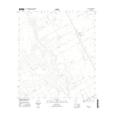
2016 Map of Lane City
USGS Topo · Published 2016About this map
The Colorado River meanders through this portion of Wharton County, defining a landscape of wetlands and alluvial plains south of the settlement at Lane City. The river's winding course is flanked by numerous tributaries, including Jarvis Cr, Jones Cr, and Bosque Cr, which reach into the surrounding agricultural and ranch lands. The presence of Pierce Ranch Rd and Pumping Station Rd suggests the historical importance of large-scale landholdings and water management for the region's economy. Residents and researchers can identify several rural road networks such as Wolf Run Rd and Bear Bottom Dr that serve the scattered homesteads and pastures. Towards the southern edge of the survey, the confluence of Blue Creek and E Fork Blue Cr highlights the complex drainage systems that characterize this part of the Texas coastal plain.
Find a feature on this map
40 named features on this map. Tap any name to fly to it.
Don’t see what you’re looking for? This feature index may not catch every label — zoom into the map to look around manually.
Map Details
Editions of this 2016 Lane City Map
This is the sole edition of this map. No revisions or reprints were ever made.
Other maps of this area

1950 · Houston
USGS Topo · 1:250,000

1951 · Danevang
USGS Topo · 1:24,000

1952 · Lane City SE
USGS Topo · 1:24,000

1952 · Pledger
USGS Topo · 1:24,000

1952 · Lane City
USGS Topo · 1:24,000

1952 · Van Vleck
USGS Topo · 1:24,000

1952 · Pierce
USGS Topo · 1:24,000

1953 · Wharton
USGS Topo · 1:24,000

1953 · Glen Flora
USGS Topo · 1:24,000

1953 · Boling
USGS Topo · 1:24,000