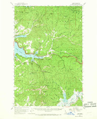
1957 Map of Lane
USGS Topo · Published 1968About this map
Coeur d'Alene National Forest dominates this mid-century landscape, where rugged peaks like Mount Coeur d'Alene and Red Horse Mtn overlook a complex network of drainages. The map details a transition from the shoreline developments of Silver Beach and Eddyville to the resource-rich interior. Evidence of early mining and surveying is preserved through labels for the Caribou Mine and several prospects, while the Elk Patrol Lookout and Airway Beacon 27 reflect the era's fire management and aviation infrastructure. A significant historical marker, the Mullan Tree Historic Site near Fourth of July Summit, anchors the map's eastern edge, documenting the path of the original wagon road. To the south, the Coeur d'Alene River valley serves as a corridor for the Pacific Union railroad, connecting remote river miles to the broader regional economy.
Find a feature on this map
93 named features on this map. Tap any name to fly to it.
Don’t see what you’re looking for? This feature index may not catch every label — zoom into the map to look around manually.
Map Details
Editions of this 1957 Lane Map
2 editions found

Other maps of this area

1903 · Rathdrum
USGS Topo · 1:125,000

1909 · Cataldo
USGS Topo · 1:125,000

1911 · Cataldo
USGS Topo · 1:125,000

1950 · Rochat Peak
USGS Topo · 1:24,000

1952 · Rochat Peak
USGS Topo · 1:24,000

1955 · Spokane
USGS Topo · 1:250,000

1957 · St. Maries
USGS Topo · 1:62,500

1957 · Kingston
USGS Topo · 1:62,500

1957 · Plummer
USGS Topo · 1:62,500

1957 · Coeur D'Alene
USGS Topo · 1:62,500