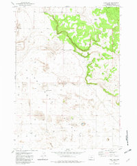
1981 Map of Lane Lake
USGS Topo · Published 1982About this map
The arid high-desert landscape of Fort Rock Valley dominates this 1981 survey, where shifting Sand Dunes and sparse water sources define the geography. The presence of the Fleetwood and Loma Vista sites suggests the traces of early homesteading attempts that once existed in this challenging environment. Human activity is largely centered on groundwater management and limited infrastructure, represented by the Landing Strip and a network of water points including Gerkin Well, Morehouse Well, and the seasonal Stingley Reservoir. The namesake Lane Lake appears as a saline basin, illustrating the closed drainage patterns common to this part of Oregon. This detailed topography provides a clear view of the natural formations like the volcanic Flatiron, which breaks the otherwise uniform sandy terrain.
Find a feature on this map
13 named features on this map. Tap any name to fly to it.
Don’t see what you’re looking for? This feature index may not catch every label — zoom into the map to look around manually.
Map Details
Editions of this 1981 Lane Lake Map
2 editions found
Other maps of this area

1955 · Crescent
USGS Topo · 1:250,000

1957 · Crescent
USGS Topo · 1:250,000

1958 · Crescent
USGS Topo · 1:250,000

1970 · Crescent
USGS Topo · 1:250,000

1981 · Hogback Butte
USGS Topo · 1:24,000

1981 · Cougar Mtn
USGS Topo · 1:24,000

1981 · Thorn Lake
USGS Topo · 1:24,000

1981 · Lane Lake
USGS Topo · 1:24,000
1981 · Tuff Butte
USGS Topo · 1:24,000
1982 · Schaub Lake
USGS Topo · 1:24,000