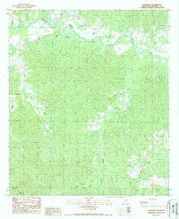
1988 Map of Laneheart
USGS Topo · Published 1988About this map
The Buffalo River meanders across the northern reaches of this Wilkinson County landscape, creating a complex hydrologic network of oxbows and backwaters. The presence of Horseshoe Lake, Webb Lake, and Beaver Lake suggests a dynamic river system where old channels have separated from the main flow. Near the river's path, a Gaging Station monitors the water levels of this significant drainage basin.
Find a feature on this map
17 named features on this map. Tap any name to fly to it.
Don’t see what you’re looking for? This feature index may not catch every label — zoom into the map to look around manually.
Map Details
Editions of this 1988 Laneheart Map
This is the sole edition of this map. No revisions or reprints were ever made.
Other maps of this area

1936 · Woodville
USGS Topo · 1:62,500

1939 · Kingston
USGS Topo · 1:62,500

1953 · Natchez
USGS Topo · 1:250,000

1956 · Natchez
USGS Topo · 1:250,000

1958 · Woodville
USGS Topo · 1:62,500

1958 · Kingston
USGS Topo · 1:62,500

1959 · Natchez
USGS Topo · 1:250,000

1961 · Crosby
USGS Topo · 1:62,500

1961 · Gloster
USGS Topo · 1:62,500

1984 · Woodville
USGS Topo · 1:100,000