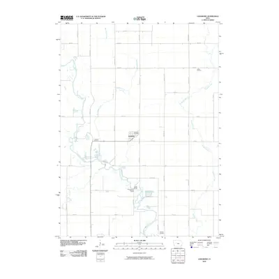
2010 Map of Lanesboro
USGS Topo · Published 2010About this map
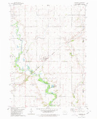
Lanesboro serves as the central hub of this agricultural landscape in Carroll County, where the grid of rural roads meets the winding course of the North Raccoon River. The town layout includes the Lanesboro Post Office and Lanesboro Cemetery, while the surrounding countryside is marked by smaller family or community burial grounds like Bishop Cemetery and Salisbury Cemetery. The terrain is defined by a network of waterways that cut across the section lines, including Purgatory Creek, Marrowbone Creek, and the small Buck Run tributary.
Find a feature on this map
39 named features on this map. Tap any name to fly to it.
Don’t see what you’re looking for? This feature index may not catch every label — zoom into the map to look around manually.
Map Details
Editions of this 2010 Lanesboro Map
This is the sole edition of this map. No revisions or reprints were ever made.
Other maps of this area

1954 · Fort Dodge
USGS Topo · 1:250,000

1957 · Fort Dodge
USGS Topo · 1:250,000

1958 · Fort Dodge
USGS Topo · 1:250,000
1980 · Glidden
USGS Topo · 1:24,000

1980 · Carroll NE
USGS Topo · 1:24,000

1980 · Yetter
USGS Topo · 1:24,000

1980 · Wightman
USGS Topo · 1:24,000
1980 · Carroll East
USGS Topo · 1:24,000
1980 · Scranton
USGS Topo · 1:24,000
1980 · Lanesboro
USGS Topo · 1:24,000