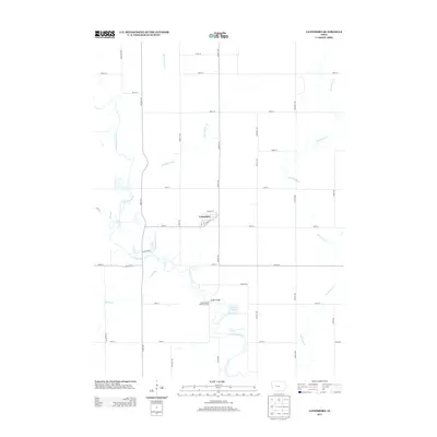
2013 Map of Lanesboro
USGS Topo · Published 2013About this map
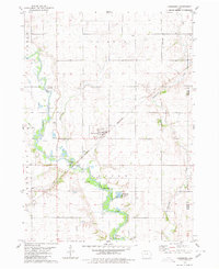
Lanesboro serves as the central hub of this agricultural landscape in Carroll County, where the town's grid of streets like 1st St and Park St meet the rural section-line roads. The region is defined by a dense network of waterways, most notably the meandering N Raccoon River which flows southward through the center of the sheet. Significant tributaries including Marrowbone Cr, Purgatory Cr, and Buck Run carve through the farm country, creating a complex drainage pattern typical of the Iowa plains. Historical crossings and conservation points are evident at Vador Bridge and the North Raccoon - Andrews Access. Near the river, Artesian Lake provides a distinct geographical feature amidst the surrounding cropland and county highways such as Co Hwy-E17.
Find a feature on this map
42 named features on this map. Tap any name to fly to it.
Don’t see what you’re looking for? This feature index may not catch every label — zoom into the map to look around manually.
Map Details
Editions of this 2013 Lanesboro Map
This is the sole edition of this map. No revisions or reprints were ever made.
Other maps of this area

1954 · Fort Dodge
USGS Topo · 1:250,000

1957 · Fort Dodge
USGS Topo · 1:250,000

1958 · Fort Dodge
USGS Topo · 1:250,000
1980 · Glidden
USGS Topo · 1:24,000

1980 · Carroll NE
USGS Topo · 1:24,000

1980 · Yetter
USGS Topo · 1:24,000

1980 · Wightman
USGS Topo · 1:24,000
1980 · Carroll East
USGS Topo · 1:24,000
1980 · Scranton
USGS Topo · 1:24,000
1980 · Lanesboro
USGS Topo · 1:24,000