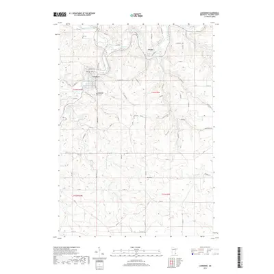
2019 Map of Lanesboro
USGS Topo · Published 2019About this map
The Root River and its major tributary, the South Branch Root River, carve a complex drainage system through Fillmore County, defining the location of settlements and transportation routes. Lanesboro occupies a sharp bend in the river, served by a network of local roads including Co Hwy 23 and Co Rd 108. To the northeast, the smaller village of Whalan sits along the northern bank near the confluence of Diamond Cr.
Find a feature on this map
71 named features on this map. Tap any name to fly to it.
Don’t see what you’re looking for? This feature index may not catch every label — zoom into the map to look around manually.
Map Details
Editions of this 2019 Lanesboro Map
This is the sole edition of this map. No revisions or reprints were ever made.
Other maps of this area

1954 · Chatfield
USGS Topo · 1:62,500

1954 · Lewiston
USGS Topo · 1:62,500

1954 · Mason City
USGS Topo · 1:250,000

1957 · Mason City
USGS Topo · 1:250,000

1958 · Mason City
USGS Topo · 1:250,000

1958 · La Crosse
USGS Topo · 1:250,000

1961 · La Crosse
USGS Topo · 1:250,000

1965 · La Crosse
USGS Topo · 1:250,000

1965 · Harmony
USGS Topo · 1:24,000

1965 · Mabel
USGS Topo · 1:24,000