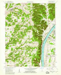
1960 Map of Lanesville
USGS Topo · Published 1967About this map
The Ohio River forms a dominant natural boundary on this 1960 survey, separating the steep ridges of Franklin and Posey townships in Indiana from the industrial activity on the Kentucky shore. The landscape is defined by its deep dissection, where ridges like New Gunn Ridge and Riley Ridge overlook numerous hollows and small watercourses. The town of Lanesville serves as a local hub, anchored by its proximity to Little Indian Creek and institutions like Lanesville Sch and several prominent cemeteries.
Find a feature on this map
71 named features on this map. Tap any name to fly to it.
Don’t see what you’re looking for? This feature index may not catch every label — zoom into the map to look around manually.
Map Details
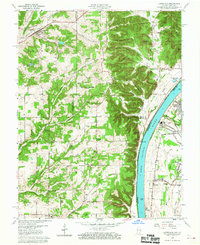
Editions of this 1960 Lanesville Map
2 editions found
Other maps of this area

1909 · Kosmosdale
USGS Topo · 1:48,000

1912 · Kosmosdale
USGS Topo · 1:62,500

1931 · Corydon
USGS Topo · 1:62,500

1939 · New Albany
USGS Topo · 1:24,000

1939 · Georgetown
USGS Topo · 1:24,000

1946 · New Albany
USGS Topo · 1:24,000

1947 · Georgetown
USGS Topo · 1:24,000

1948 · Corydon East
USGS Topo · 1:24,000

1948 · Laconia
USGS Topo · 1:24,000

1949 · Georgetown
USGS Topo · 1:24,000