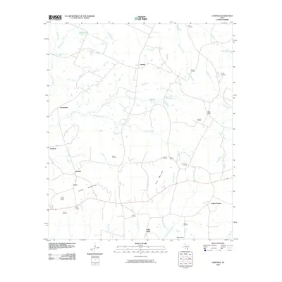
2010 Map of Laneville
USGS Topo · Published 2010About this map
Laneville and the surrounding Rusk County countryside are defined by a network of creek branches and small settlements in this 2010 survey. The landscape transitions from the higher elevations of the Elkins Mountains and Siris Mountain in the south toward the winding Angelina River and its various tributaries like Anadarko Creek and Buckner Creek. This map is particularly valuable for genealogical research, documenting numerous rural burial sites including Shiloh Cemetery, Bagley Cemetery, and the Lyles-Sanders Cemetery. Small communities like Freeneytown, Glenfawn, and Anadarko remain linked by a web of local roads, while the Hunter Lowry Airport stands as a notable modern landmark near the western edge. The drainage patterns of named waterways, such as Reagan Branch and Everett Branch, provide a detailed framework for understanding the historical land use and settlement distribution in this pocket of East Texas.
Find a feature on this map
47 named features on this map. Tap any name to fly to it.
Don’t see what you’re looking for? This feature index may not catch every label — zoom into the map to look around manually.
Map Details
Editions of this 2010 Laneville Map
This is the sole edition of this map. No revisions or reprints were ever made.
Other maps of this area

1935 · Henderson
USGS Topo · 1:48,000

1939 · Henderson
USGS Topo · 1:62,500

1943 · Cushing
USGS Topo · 1:62,500

1945 · Cushing
USGS Topo · 1:62,500

1953 · Palestine
USGS Topo · 1:250,000

1956 · Tyler
USGS Topo · 1:250,000

1957 · Palestine
USGS Topo · 1:250,000

1960 · Minden
USGS Topo · 1:62,500

1960 · Mount Enterprise
USGS Topo · 1:62,500

1973 · Cushing
USGS Topo · 1:24,000