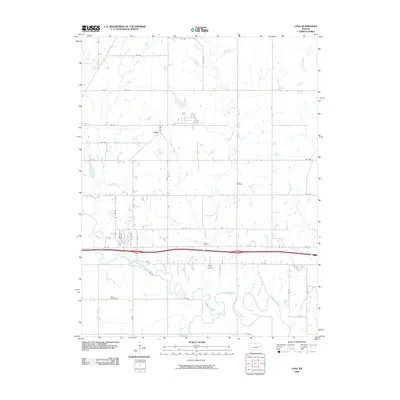
2009 Map of Lang
USGS Topo · Published 2009About this map
Lang sits as a quiet focal point in this Lyon County landscape, where the agricultural grid is defined by a series of north-south and east-west roads. The northern portion of the map is dominated by the drainages of Plumb Creek, Coon Creek, and Badger Creek, which feed southward toward the more complex hydrology of the Neosho River. This river corridor in the south features a highly sinuous channel with numerous oxbows and meanders, indicating a broad, active floodplain.
Find a feature on this map
32 named features on this map. Tap any name to fly to it.
Don’t see what you’re looking for? This feature index may not catch every label — zoom into the map to look around manually.
Map Details
Editions of this 2009 Lang Map
This is the sole edition of this map. No revisions or reprints were ever made.
Other maps of this area

1885 · Eskridge
USGS Topo · 1:125,000

1885 · Burlington
USGS Topo · 1:125,000

1888 · Emporia
USGS Topo · 1:125,000

1889 · Burlingame
USGS Topo · 1:125,000

1889 · Eskridge
USGS Topo · 1:125,000

1894 · Emporia
USGS Topo · 1:125,000

1894 · Eskridge
USGS Topo · 1:125,000

1894 · Burlingame
USGS Topo · 1:125,000

1894 · Burlington
USGS Topo · 1:125,000

1947 · Lawrence
USGS Topo · 1:250,000