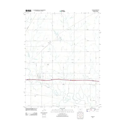
2012 Map of Lang
USGS Topo · Published 2012About this map
The confluence of the Neosho River and the Cottonwood River anchors the southern portion of this Lyon County landscape, where winding riparian corridors break the geometric grid of agricultural roads. The small settlement of Lang sits along the northern reaches, served by Road 205 and Road R. This 2012 survey illustrates a deeply rooted rural community, evidenced by several established burial grounds including Badger Creek Cem, Hunter Cem, and Union Cem situated between the meandering creek beds. Aviation and transit are marked by the Sickler Airstrip and the prominent corridor of Road 175 cutting east-to-west across the center. Numerous tributaries such as Badger Cr, Plumb Cr, and Coon Cr drain the surrounding fields, defining the drainage patterns that have shaped the region's land use for generations.
Find a feature on this map
44 named features on this map. Tap any name to fly to it.
Don’t see what you’re looking for? This feature index may not catch every label — zoom into the map to look around manually.
Map Details
Editions of this 2012 Lang Map
This is the sole edition of this map. No revisions or reprints were ever made.
Other maps of this area

1885 · Eskridge
USGS Topo · 1:125,000

1885 · Burlington
USGS Topo · 1:125,000

1888 · Emporia
USGS Topo · 1:125,000

1889 · Burlingame
USGS Topo · 1:125,000

1889 · Eskridge
USGS Topo · 1:125,000

1894 · Emporia
USGS Topo · 1:125,000

1894 · Eskridge
USGS Topo · 1:125,000

1894 · Burlingame
USGS Topo · 1:125,000

1894 · Burlington
USGS Topo · 1:125,000

1947 · Lawrence
USGS Topo · 1:250,000