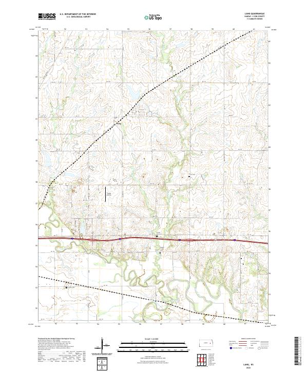
2022 Map of Lang
USGS Topo · Published 2022About this map
The confluence of the Neosho River and the Cottonwood River defines the southern landscape of this Lyon County region, where the two waterways weave together through a low-lying valley. This 2022 survey captures the small settlement of Lang situated along the northern reaches of Plumb Cr, surrounded by a network of rural routes like Burlingame Rd and Rd 200. The area is marked by several significant burial grounds including Forest Hill Cem, Badger Creek Cem, Union Cem, and Fowler Cem, providing essential landmarks for genealogical research and local history. Land use is largely agricultural, punctuated by features such as the Sickler Airstrip and numerous smaller tributaries like Coon Cr and Badger Cr that feed into the primary river systems.
Find a feature on this map
33 named features on this map. Tap any name to fly to it.
Don’t see what you’re looking for? This feature index may not catch every label — zoom into the map to look around manually.
Map Details
Editions of this 2022 Lang Map
This is the sole edition of this map. No revisions or reprints were ever made.
Other maps of this area

1885 · Eskridge
USGS Topo · 1:125,000

1885 · Burlington
USGS Topo · 1:125,000

1888 · Emporia
USGS Topo · 1:125,000

1889 · Burlingame
USGS Topo · 1:125,000

1889 · Eskridge
USGS Topo · 1:125,000

1894 · Emporia
USGS Topo · 1:125,000

1894 · Eskridge
USGS Topo · 1:125,000

1894 · Burlingame
USGS Topo · 1:125,000

1894 · Burlington
USGS Topo · 1:125,000

1947 · Lawrence
USGS Topo · 1:250,000