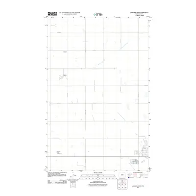
2011 Map of Langdon West
USGS Topo · Published 2011About this map
The Little South Pembina River meanders across this rural North Dakota landscape, defining the local topography between agricultural sections. The settlement of Dresden sits along Dresden Rd, serving as a central point in a grid of section roads like 100th St NE and 102nd Ave NE. This 2011 survey documents the proximity of aviation to local agriculture, featuring both the Langdon Municipal Airport and the Walts Air Service Landing Strip. For those researching family history in Cavalier County, the map provides precise locations for Redeemer Cemetery near the river and Calvary Cemetery on the outskirts of the primary settlement area. The landscape is primarily organized by a strict rectilinear road network, characteristic of the northern plains, where utility and transport follow the established township lines.
Find a feature on this map
24 named features on this map. Tap any name to fly to it.
Don’t see what you’re looking for? This feature index may not catch every label — zoom into the map to look around manually.
Map Details
Editions of this 2011 Langdon West Map
This is the sole edition of this map. No revisions or reprints were ever made.
Other maps of this area

1953 · Devils Lake
USGS Topo · 1:250,000

1956 · Devils Lake
USGS Topo · 1:250,000

1967 · Langdon East
USGS Topo · 1:24,000

1967 · Maida
USGS Topo · 1:24,000

1970 · Mount Carmel
USGS Topo · 1:24,000

1970 · Wales
USGS Topo · 1:24,000

1970 · Loma
USGS Topo · 1:24,000

1970 · Hannah SE
USGS Topo · 1:24,000

1970 · Langdon West
USGS Topo · 1:24,000

1972 · Easby
USGS Topo · 1:24,000