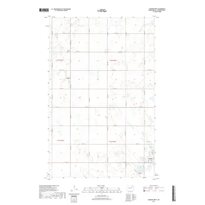
2017 Map of Langdon West
USGS Topo · Published 2017About this map
Dresden sits at the intersection of Dresden Rd and 98th St NE, serving as a quiet focal point in this agricultural landscape of Cavalier County. This 2017 survey illustrates a region defined by its section-line roads and the meandering path of the Little S Pembina River, which cuts across the prairie towards the northeast. In the southeastern corner, the outskirts of Langdon reveal a more developed infrastructure, including the Langdon Reservoir and Robertson Field. Local history and genealogy researchers can locate specific burial sites at Redeemer Cem north of Dresden and Calvary Cem near the city of Langdon. The map provides a contemporary view of the Public Land Survey System, clearly marking townships such as t162n r61w and t162n r60w, which organize the vast stretches of farmland that dominate the terrain.
Find a feature on this map
35 named features on this map. Tap any name to fly to it.
Don’t see what you’re looking for? This feature index may not catch every label — zoom into the map to look around manually.
Map Details
Editions of this 2017 Langdon West Map
This is the sole edition of this map. No revisions or reprints were ever made.
Other maps of this area

1953 · Devils Lake
USGS Topo · 1:250,000

1956 · Devils Lake
USGS Topo · 1:250,000

1967 · Langdon East
USGS Topo · 1:24,000

1967 · Maida
USGS Topo · 1:24,000

1970 · Mount Carmel
USGS Topo · 1:24,000

1970 · Wales
USGS Topo · 1:24,000

1970 · Loma
USGS Topo · 1:24,000

1970 · Hannah SE
USGS Topo · 1:24,000

1970 · Langdon West
USGS Topo · 1:24,000

1972 · Easby
USGS Topo · 1:24,000