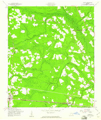
1958 Map of Lanier
USGS Topo · Published 1961About this map
Pembroke serves as a primary hub of settlement in the post-war era, situated along the southern corridor of the Seaboard Air Line railroad. This landscape is characterized by its complex water systems, where Lower Black Creek and Upper Black Creek converge around islands such as Moonshine Island and Jennett Island. The map reveals a rural community supported by a network of local institutions, including the Ash Branch Ch and the Mill Creek Sch, which provided essential social foundations for the surrounding farms.
Find a feature on this map
23 named features on this map. Tap any name to fly to it.
Don’t see what you’re looking for? This feature index may not catch every label — zoom into the map to look around manually.
Map Details
Editions of this 1958 Lanier Map
3 editions found
Other maps of this area

1919 · Egypt
USGS Topo · 1:62,500

1920 · Pembroke
USGS Topo · 1:62,500

1920 · Meldrim
USGS Topo · 1:62,500

1921 · Brooklet
USGS Topo · 1:62,500

1939 · Egypt
USGS Topo · 1:62,500

1942 · Meldrim
USGS Topo · 1:62,500

1943 · Brooklet
USGS Topo · 1:62,500

1943 · Egypt
USGS Topo · 1:62,500

1947 · Savannah
USGS Topo · 1:250,000

1948 · Savannah
USGS Topo · 1:250,000