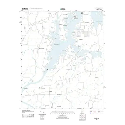
2011 Map of Laniers
USGS Topo · Published 2011About this map
Logan Martin Lake dominates this Alabama landscape, its irregular shoreline creating a complex network of bays and islands. Along the northern waters, residential and recreational clusters like Saint Clair Shores and Logan Martin Pines appear alongside numerous maritime facilities including General Lee Marina and Surfside Marina. The southern portion of the sheet transitions into the more riverine environment of Lay Lake, anchored by the Logan Martin Dam.
Find a feature on this map
138 named features on this map. Tap any name to fly to it.
Don’t see what you’re looking for? This feature index may not catch every label — zoom into the map to look around manually.
Map Details
Editions of this 2011 Laniers Map
This is the sole edition of this map. No revisions or reprints were ever made.
Other maps of this area

1889 · Springville
USGS Topo · 1:125,000

1890 · Talladega
USGS Topo · 1:125,000

1892 · Springville
USGS Topo · 1:125,000

1892 · Talladega
USGS Topo · 1:125,000

1943 · Talladega
USGS Topo · 1:62,500

1946 · Talladega
USGS Topo · 1:62,500

1947 · Ragland
USGS Topo · 1:62,500

1947 · Riverside
USGS Topo · 1:24,000

1951 · Vincent
USGS Topo · 1:24,000

1951 · Laniers
USGS Topo · 1:24,000