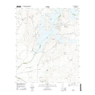
2014 Map of Laniers
USGS Topo · Published 2014About this map
Logan Martin Lake dominates this Alabama landscape at the intersection of St. Clair, Talladega, and Shelby Counties. The intricate shoreline of the reservoir creates numerous peninsulas and islands, including Treasure Island, Merkl Island, and Grissom Island, where residential developments like Alpine Bay have emerged. The map documents the persistent rural character of the region beyond the waterfront, where several small settlements and crossroads communities such as Briarfield, Laniers, and Feddisburg are situated.
Find a feature on this map
147 named features on this map. Tap any name to fly to it.
Don’t see what you’re looking for? This feature index may not catch every label — zoom into the map to look around manually.
Map Details
Editions of this 2014 Laniers Map
This is the sole edition of this map. No revisions or reprints were ever made.
Other maps of this area

1889 · Springville
USGS Topo · 1:125,000

1890 · Talladega
USGS Topo · 1:125,000

1892 · Springville
USGS Topo · 1:125,000

1892 · Talladega
USGS Topo · 1:125,000

1943 · Talladega
USGS Topo · 1:62,500

1946 · Talladega
USGS Topo · 1:62,500

1947 · Ragland
USGS Topo · 1:62,500

1947 · Riverside
USGS Topo · 1:24,000

1951 · Vincent
USGS Topo · 1:24,000

1951 · Laniers
USGS Topo · 1:24,000