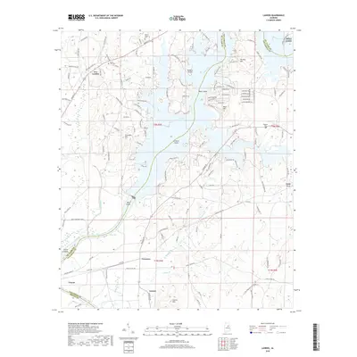
2018 Map of Laniers
USGS Topo · Published 2018About this map
Logan Martin Lake dominates this landscape where the Coosa River flows through the junction of St. Clair, Talladega, and Shelby Counties. The flooded river valley forms a complex shoreline of inlets and islands, including Treasure Island and Grissom Island, reflecting the 20th-century transformation of the river for hydroelectric power and recreation. Inland from the water, the terrain is marked by prominent elevations such as Stracener Mtn and Laniers Mtn, while the settlement at New London and the edges of Pell City show the area's residential growth. Longstanding community anchors like Mount Pisgah Cem and Hubbard Cem sit alongside established rural routes such as Grovers Ferry Rd and Kelly Creek Rd. Near the southern reaches, the transition to Lay Lake occurs past the community of Laniers, where Kelly Creek meets the river.
Find a feature on this map
148 named features on this map. Tap any name to fly to it.
Don’t see what you’re looking for? This feature index may not catch every label — zoom into the map to look around manually.
Map Details
Editions of this 2018 Laniers Map
This is the sole edition of this map. No revisions or reprints were ever made.
Other maps of this area

1889 · Springville
USGS Topo · 1:125,000

1890 · Talladega
USGS Topo · 1:125,000

1892 · Springville
USGS Topo · 1:125,000

1892 · Talladega
USGS Topo · 1:125,000

1943 · Talladega
USGS Topo · 1:62,500

1946 · Talladega
USGS Topo · 1:62,500

1947 · Ragland
USGS Topo · 1:62,500

1947 · Riverside
USGS Topo · 1:24,000

1951 · Vincent
USGS Topo · 1:24,000

1951 · Laniers
USGS Topo · 1:24,000