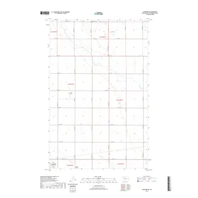
2017 Map of Lansford NE
USGS Topo · Published 2017About this map
The town of Lansford anchors the southwestern corner of this Bottineau County landscape, where the prairie is defined by a rigorous grid of section lines and gravel roads. In the northern reaches, the Renville Cem provides a point of historical continuity for the rural community, while the presence of Oil Well Rd and the Undlin Airstrip reflects the region's mid-century industrial and transport evolution. The terrain is marked by the winding path of Cut Bank Creek and its smaller tributary Cut Bank Cr, which carve shallow drainage patterns across the northern half of the survey. To the south, Spring Coulee cuts through the landscape near the town site. This 2017 data reflects a modern era of land management, yet the underlying township structure of t160n r83w and t161n r82w preserves the foundational 19th-century surveying system that first organized this agricultural territory.
Find a feature on this map
31 named features on this map. Tap any name to fly to it.
Don’t see what you’re looking for? This feature index may not catch every label — zoom into the map to look around manually.
Map Details
Editions of this 2017 Lansford NE Map
This is the sole edition of this map. No revisions or reprints were ever made.
Other maps of this area

1948 · Dokken SW
USGS Topo · 1:24,000

1948 · Lansford
USGS Topo · 1:62,500

1948 · Lansford SW
USGS Topo · 1:24,000

1949 · Glenburn
USGS Topo · 1:24,000

1949 · Lansford NW
USGS Topo · 1:24,000

1949 · Lansford SW
USGS Topo · 1:24,000

1949 · Lansford SE
USGS Topo · 1:24,000

1949 · Lansford NE
USGS Topo · 1:24,000

1949 · Maxbass
USGS Topo · 1:24,000

1949 · Westhope SW
USGS Topo · 1:24,000