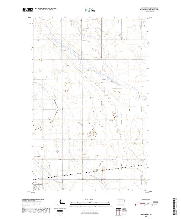
2024 Map of Lansford NE
USGS Topo · Published 2024About this map
Cut Bank Creek meanders through this agricultural landscape in Bottineau County, defining the drainage patterns of the northern plains. The map reveals a strictly organized section-line road grid, including Oil Well Rd and various numbered avenues, which supports a rural economy of isolated farmsteads and transport. Near the northern border, the Renville Cem serves as a significant genealogical marker for the surrounding community. Small-scale aviation infrastructure is represented by the Undlin Airstrip, located west of the central grid. In the southwestern corner, the outskirts of a settlement emerge with the naming of Main St and Laurel St near Spring Coulee, providing a rare point of concentrated survey detail in an otherwise expansive patchwork of fields and wetlands.
Find a feature on this map
29 named features on this map. Tap any name to fly to it.
Don’t see what you’re looking for? This feature index may not catch every label — zoom into the map to look around manually.
Map Details
Editions of this 2024 Lansford NE Map
This is the sole edition of this map. No revisions or reprints were ever made.
Other maps of this area

1948 · Dokken SW
USGS Topo · 1:24,000

1948 · Lansford
USGS Topo · 1:62,500

1948 · Lansford SW
USGS Topo · 1:24,000

1949 · Glenburn
USGS Topo · 1:24,000

1949 · Lansford NW
USGS Topo · 1:24,000

1949 · Lansford SW
USGS Topo · 1:24,000

1949 · Lansford SE
USGS Topo · 1:24,000

1949 · Lansford NE
USGS Topo · 1:24,000

1949 · Maxbass
USGS Topo · 1:24,000

1949 · Westhope SW
USGS Topo · 1:24,000