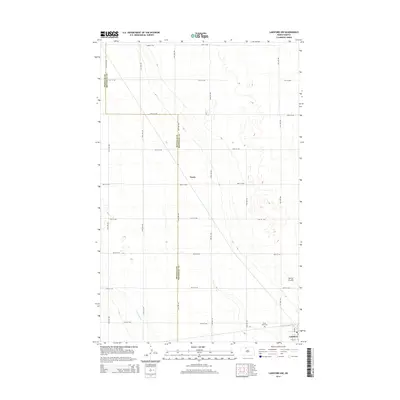
2014 Map of Lansford NW
USGS Topo · Published 2014About this map
Renville and Bottineau counties divide the agricultural landscape of this North Dakota quadrangle, where a rectilinear grid of section roads like 92nd St NW and 36th Ave NW organizes the high plains. The small community of Truro serves as a central landmark amidst the open fields, while the city of Lansford anchors the southeastern corner. This area is defined by its subtle drainage patterns, including the winding course of Little Deep Creek and the low-lying Spring Coulee. Genealogists and local historians can locate Saint Johns Cemetery in the southern portion of the map, a vital site for family research in this sparsely populated region. The map captures the enduring character of the prairie before modern consolidation, showing the precise intersection of county lines and local farm-to-market routes.
Find a feature on this map
23 named features on this map. Tap any name to fly to it.
Don’t see what you’re looking for? This feature index may not catch every label — zoom into the map to look around manually.
Map Details
Editions of this 2014 Lansford NW Map
This is the sole edition of this map. No revisions or reprints were ever made.
Other maps of this area

1948 · Dokken SW
USGS Topo · 1:24,000

1948 · Mohall
USGS Topo · 1:24,000

1948 · Lansford
USGS Topo · 1:62,500

1948 · Lansford SW
USGS Topo · 1:24,000

1949 · Lansford NW
USGS Topo · 1:24,000

1949 · Lansford SW
USGS Topo · 1:24,000

1949 · Grano
USGS Topo · 1:24,000

1949 · Lansford SE
USGS Topo · 1:24,000

1949 · Lansford NE
USGS Topo · 1:24,000

1949 · Grano NE
USGS Topo · 1:24,000