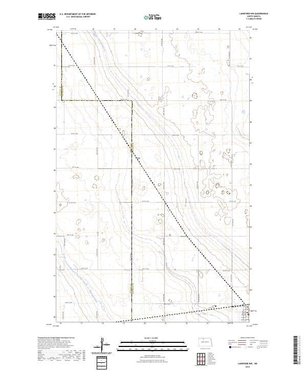
2024 Map of Lansford NW
USGS Topo · Published 2024About this map
The prairie landscape along the border of Renville Co Bottineau Co is defined by the section-line grid of the Public Land Survey System, a pattern that has dictated the placement of rural homesteads and transport corridors for over a century. The settlement of Truro sits along this county line, serving as a focal point for the surrounding agricultural community. To the southeast, the Saint Johns Cem provides a genealogical touchstone for the region's early families. The terrain is marked by numerous glacial prairie potholes and small depressions, with the drainage of Little Deep Creek meandering through the southwest corner. The regular spacing of roads like 92nd St NW and 34th Ave NW illustrates the enduring influence of the 19th-century land ordinance on contemporary North Dakota geography.
Find a feature on this map
28 named features on this map. Tap any name to fly to it.
Don’t see what you’re looking for? This feature index may not catch every label — zoom into the map to look around manually.
Map Details
Editions of this 2024 Lansford NW Map
This is the sole edition of this map. No revisions or reprints were ever made.
Other maps of this area

1948 · Dokken SW
USGS Topo · 1:24,000

1948 · Mohall
USGS Topo · 1:24,000

1948 · Lansford
USGS Topo · 1:62,500

1948 · Lansford SW
USGS Topo · 1:24,000

1949 · Lansford NW
USGS Topo · 1:24,000

1949 · Lansford SW
USGS Topo · 1:24,000

1949 · Grano
USGS Topo · 1:24,000

1949 · Lansford SE
USGS Topo · 1:24,000

1949 · Lansford NE
USGS Topo · 1:24,000

1949 · Grano NE
USGS Topo · 1:24,000