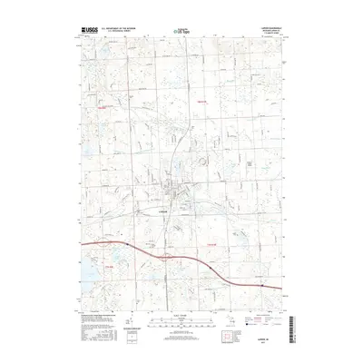
2017 Map of Lapeer
USGS Topo · Published 2017About this map
The Lapeer city center serves as the hub for this region, situated where the CN railroad lines intersect the local drainage networks. The landscape is defined by the winding course of the South Branch Flint River and an extensive system of agricultural drains, including the Mayfield and Oregon Drain and Sand Hill Drain. This drainage infrastructure underscores the area's legacy of managing the low-lying terrain for productive use. Several sizable water bodies dot the township lines, most notably Nepessing Lake and McKeen Lake to the west, and Rood Lake to the north.
Find a feature on this map
156 named features on this map. Tap any name to fly to it.
Don’t see what you’re looking for? This feature index may not catch every label — zoom into the map to look around manually.
Map Details
Editions of this 2017 Lapeer Map
This is the sole edition of this map. No revisions or reprints were ever made.
Other maps of this area

1943 · Metamora
USGS Topo · 1:24,000

1945 · Thornville
USGS Topo · 1:24,000

1945 · Hadley
USGS Topo · 1:24,000

1946 · Metamora
USGS Topo · 1:24,000

1954 · Detroit
USGS Topo · 1:250,000

1954 · Flint
USGS Topo · 1:250,000

1958 · Flint
USGS Topo · 1:250,000

1961 · Detroit
USGS Topo · 1:250,000

1963 · Attica
USGS Topo · 1:24,000

1963 · North Branch
USGS Topo · 1:24,000