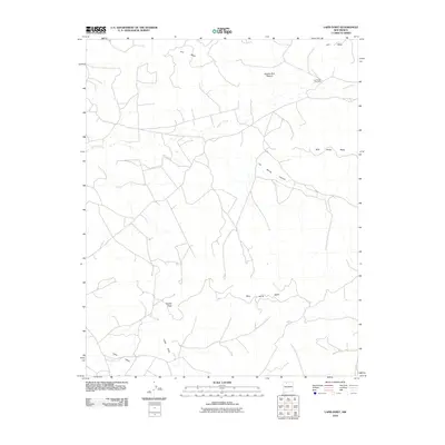
2010 Map of Lapis Point
USGS Topo · Published 2010About this map
Lapis Valley and the surrounding high-desert terrain of Rio Arriba County are defined by a network of expansive plateaus and drainage systems. This 2010 USGS survey shows a landscape managed for ranching and resource use, centered around the topographical prominence of Lapis Point and the vast Wild Horse Mesa. The presence of Las Norias Windmill and named enclosures like Apache Buil Pasture indicate the ongoing importance of water management in this arid region, where seasonal flows like Tapicito Creek and the deep cuts of Las Norias Canyon shape the movement of people and livestock. Away from major population centers, the map documents small landmarks such as Eagles Nest, providing a record of the specific local nomenclature used by those working the land atop B S Mesa.
Find a feature on this map
9 named features on this map. Tap any name to fly to it.
Don’t see what you’re looking for? This feature index may not catch every label — zoom into the map to look around manually.
Map Details
Editions of this 2010 Lapis Point Map
This is the sole edition of this map. No revisions or reprints were ever made.
Other maps of this area

1889 · Largo
USGS Topo · 1:250,000

1895 · Largo
USGS Topo · 1:250,000

1954 · Aztec
USGS Topo · 1:250,000

1958 · Aztec
USGS Topo · 1:250,000

1962 · Aztec
USGS Topo · 1:250,000

1963 · Lapis Point
USGS Topo · 1:24,000

1963 · Schmitz Ranch
USGS Topo · 1:24,000

1963 · Tayfoya Canyon
USGS Topo · 1:24,000

1963 · Gonzales Mesa
USGS Topo · 1:24,000

1963 · Otero Store
USGS Topo · 1:24,000