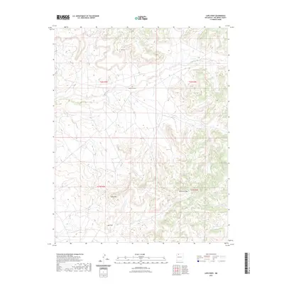
2023 Map of Lapis Point
USGS Topo · Published 2023About this map
Lapis Point and the surrounding high-desert terrain of Rio Arriba County define this landscape, where deep drainages like Las Norias Canyon cut through a series of elevated mesas. This 2023 survey by the U.S. Geological Survey illustrates the complex topography of the Jicarilla Apache region, characterized by the winding path of Tapicito Creek in the northern reaches and the distinct prominence of B S Mesa. The area's verticality is punctuated by landmarks such as Eagles Nest and Wild Horse Mesa, which reflect the remote and undeveloped nature of this part of New Mexico. The map provides a detailed view of the Public Land Survey System (PLSS) grid, documenting the boundaries of townships such as t26n r5w and t25n r4w in a region where natural landforms dictate the few available routes and human footprints.
Find a feature on this map
10 named features on this map. Tap any name to fly to it.
Don’t see what you’re looking for? This feature index may not catch every label — zoom into the map to look around manually.
Map Details
Editions of this 2023 Lapis Point Map
This is the sole edition of this map. No revisions or reprints were ever made.
Other maps of this area

1889 · Largo
USGS Topo · 1:250,000

1895 · Largo
USGS Topo · 1:250,000

1954 · Aztec
USGS Topo · 1:250,000

1958 · Aztec
USGS Topo · 1:250,000

1962 · Aztec
USGS Topo · 1:250,000

1963 · Lapis Point
USGS Topo · 1:24,000

1963 · Schmitz Ranch
USGS Topo · 1:24,000

1963 · Tayfoya Canyon
USGS Topo · 1:24,000

1963 · Gonzales Mesa
USGS Topo · 1:24,000

1963 · Otero Store
USGS Topo · 1:24,000