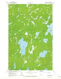
1963 Map of Lapond Lake
USGS Topo · Published 1965About this map
Superior National Forest and Burnt Side State Forest dominate this 1960s landscape, which is defined by an intricate network of waterways and portages. The Moose River and Portage River navigate a series of rapids and falls, linking substantial bodies of water including Big Moose Lake and Big Rice Lake. The inclusion of depth curves and soundings for several lakes, provided by the Minnesota Department of Conservation, offers rare underwater topography for wilderness navigation. Small-scale resource extraction is visible through several Gravel Pits and a sandpit, while a Jeep Trail provides the only significant land-based penetration into the dense woods. This map captures the area before modern recreational intensity, preserving the location of established campsites along the river bends.
Find a feature on this map
22 named features on this map. Tap any name to fly to it.
Don’t see what you’re looking for? This feature index may not catch every label — zoom into the map to look around manually.
Map Details
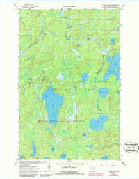
Editions of this 1963 Lapond Lake Map
2 editions found
Other maps of this area

1933 · Ely
USGS Topo · 1:62,500

1939 · Ely
USGS Topo · 1:62,500

1954 · Two Harbors
USGS Topo · 1:250,000

1954 · Hibbing
USGS Topo · 1:250,000

1954 · International Falls
USGS Topo · 1:250,000

1956 · Chad Lake
USGS Topo · 1:24,000

1956 · Crab Lake
USGS Topo · 1:24,000

1957 · Two Harbors
USGS Topo · 1:250,000

1957 · Hibbing
USGS Topo · 1:250,000

1957 · International Falls
USGS Topo · 1:250,000