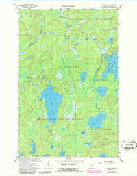
1963 Map of Lapond Lake
USGS Topo · Published 1986About this map
Big Moose Lake dominates the central portion of this wilderness landscape, serving as a focal point within the Boundary Waters Canoe Area Wilderness. This 1963 survey, updated with 1986 revisions, details an intricate aquatic network where the Portage River and Moose River navigate through numerous rapids. The map illustrates the fundamental character of the Superior National Forest before modern developments, highlighting a landscape defined by connectivity through water and trails rather than roads.
Find a feature on this map
25 named features on this map. Tap any name to fly to it.
Don’t see what you’re looking for? This feature index may not catch every label — zoom into the map to look around manually.
Map Details
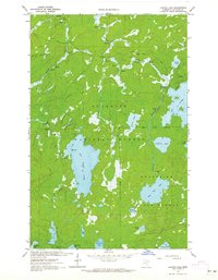
Editions of this 1963 Lapond Lake Map
2 editions found
Other maps of this area

1933 · Ely
USGS Topo · 1:62,500

1939 · Ely
USGS Topo · 1:62,500

1954 · Two Harbors
USGS Topo · 1:250,000

1954 · Hibbing
USGS Topo · 1:250,000

1954 · International Falls
USGS Topo · 1:250,000

1956 · Chad Lake
USGS Topo · 1:24,000

1956 · Crab Lake
USGS Topo · 1:24,000

1957 · Two Harbors
USGS Topo · 1:250,000

1957 · Hibbing
USGS Topo · 1:250,000

1957 · International Falls
USGS Topo · 1:250,000