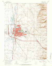
1963 Map of Laramie
USGS Topo · Published 1964About this map
The University of Wyoming anchors this mid-century look at Albany County, showing the city's residential and educational expansion east of the Laramie River. To the south, the historic military presence is recorded at the Ft Sanders (Site), while the agricultural legacy of the region is evident at the Experimental Farm and Howe Airfield. The landscape is a study in early 1960s infrastructure, featuring a dense network of local schools like Slade Sch and St Lawrence Sch, alongside heavy industrial footprints such as the Cement Plant and Shale Aggregate Plant near the Union Pacific tracks. On the western edge, the separate settlement of West Laramie sits across the river, while the eastern terrain rises toward the canyons of Pilot Mountain and Jack Rabbit Canyon.
Find a feature on this map
54 named features on this map. Tap any name to fly to it.
Don’t see what you’re looking for? This feature index may not catch every label — zoom into the map to look around manually.
Map Details
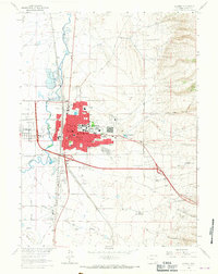
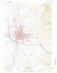
Editions of this 1963 Laramie Map
3 editions found
Other maps of this area

1895 · Laramie
USGS Topo · 1:125,000

1902 · Laramie
USGS Topo · 1:125,000

1905 · Sherman
USGS Topo · 1:125,000

1905 · Laramie
USGS Topo · 1:125,000

1906 · Laramie
USGS Topo · 1:125,000

1908 · Laramie
USGS Topo · 1:125,000

1948 · Sherman Mountains
USGS Topo · 1:62,500

1948 · Ragged Top Mountain
USGS Topo · 1:62,500

1950 · Ragged Top Mountain
USGS Topo · 1:62,500

1950 · Sherman Mountains
USGS Topo · 1:62,500