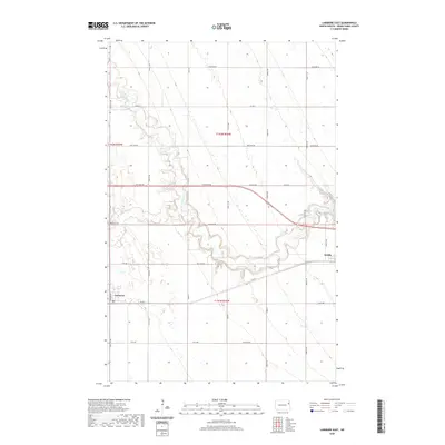
2020 Map of Larimore East
USGS Topo · Published 2020About this map
Larimore and Arvilla anchor this section of the Red River Valley, where the flat agricultural plains of Grand Forks County are carved by the winding paths of the Turtle River. The landscape is defined by the confluence of the N Br Turtle River and S Br Turtle River, which create a complex network of riparian corridors through the otherwise gridded section lines. This modern survey illustrates how long-established community anchors like Bellevue Cem and local arteries such as Towner Ave and Co Rd 4 integrate with the region's vast acreage. The map provides a precise view of the rural township structure, including t152n r55w, t152n r54w, and t151n r54w, showing the enduring layout of prairie farmsteads and the transport network that connects these eastern North Dakota settlements.
Find a feature on this map
32 named features on this map. Tap any name to fly to it.
Don’t see what you’re looking for? This feature index may not catch every label — zoom into the map to look around manually.
Map Details
Editions of this 2020 Larimore East Map
This is the sole edition of this map. No revisions or reprints were ever made.
Other maps of this area

1926 · Ardoch
USGS Topo · 1:62,500

1934 · Emerado
USGS Topo · 1:48,000

1936 · Emerado
USGS Topo · 1:62,500

1936 · Larimore
USGS Topo · 1:62,500

1952 · Grand Forks
USGS Topo · 1:250,000

1952 · Thief River Falls
USGS Topo · 1:250,000

1956 · Thief River Falls
USGS Topo · 1:250,000

1956 · Grand Forks
USGS Topo · 1:250,000

1957 · Thief River Falls
USGS Topo · 1:250,000

1963 · Orr
USGS Topo · 1:24,000