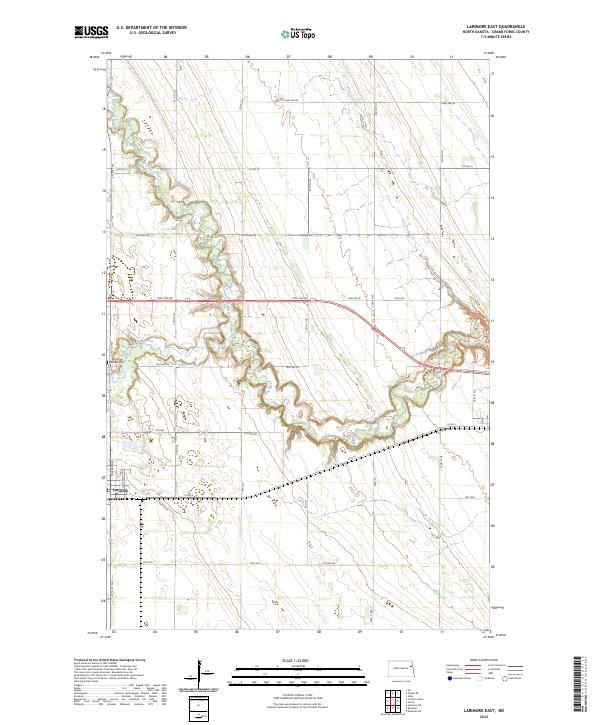
2024 Map of Larimore East
USGS Topo · Published 2024About this map
Larimore anchors the southwestern edge of this Red River Valley landscape, where the flat agricultural plains of Grand Forks County are deeply etched by the meandering course of the Turtle River. The drainage pattern is the defining characteristic here, with the North Branch Turtle River and South Branch Turtle River winding through section lines to converge into a single, heavily wooded riparian corridor. This 2024 survey illustrates a highly organized township-and-range grid, where primary arteries like Co Rd 4 and Co Rd 11 facilitate movement between vast tracts of farmland. Near the river's bend, Bellevue Cem serves as a quiet landmark for local genealogists, reflecting the established rural community that has long depended on these fertile North Dakota soils.
Find a feature on this map
31 named features on this map. Tap any name to fly to it.
Don’t see what you’re looking for? This feature index may not catch every label — zoom into the map to look around manually.
Map Details
Editions of this 2024 Larimore East Map
This is the sole edition of this map. No revisions or reprints were ever made.
Other maps of this area

1926 · Ardoch
USGS Topo · 1:62,500

1934 · Emerado
USGS Topo · 1:48,000

1936 · Emerado
USGS Topo · 1:62,500

1936 · Larimore
USGS Topo · 1:62,500

1952 · Grand Forks
USGS Topo · 1:250,000

1952 · Thief River Falls
USGS Topo · 1:250,000

1956 · Thief River Falls
USGS Topo · 1:250,000

1956 · Grand Forks
USGS Topo · 1:250,000

1957 · Thief River Falls
USGS Topo · 1:250,000

1963 · Orr
USGS Topo · 1:24,000