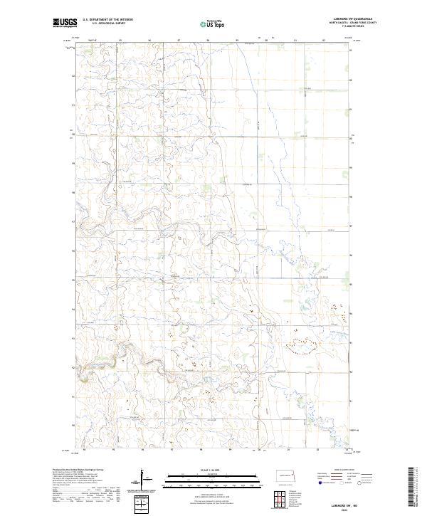
2024 Map of Larimore SW
USGS Topo · Published 2024About this map
The Little Goose River and the Goose River meander through the prairie landscape of Grand Forks County in this recent 2024 survey. The topography is defined by the winding paths of these waterways, which are joined by Spring Creek in the southwestern portion of the quadrangle. This area of North Dakota maintains a traditional agrarian grid, where long-established section lines are served by local roads such as 42nd St and Co Rd 20. The map documents a landscape of quiet utility, where the natural drainage of the river systems intersects with a disciplined network of rural avenues, including 14th Ave NE and 6th Ave NE. It is an essential record of the contemporary rural structure in the Red River Valley region.
Find a feature on this map
21 named features on this map. Tap any name to fly to it.
Don’t see what you’re looking for? This feature index may not catch every label — zoom into the map to look around manually.
Map Details
Editions of this 2024 Larimore SW Map
This is the sole edition of this map. No revisions or reprints were ever made.
Other maps of this area

1936 · Larimore
USGS Topo · 1:62,500

1939 · Niagara
USGS Topo · 1:62,500

1952 · Grand Forks
USGS Topo · 1:250,000

1956 · Grand Forks
USGS Topo · 1:250,000

1963 · Larimore East
USGS Topo · 1:24,000

1963 · Kempton
USGS Topo · 1:24,000

1963 · Larimore SW
USGS Topo · 1:24,000

1963 · Larimore West
USGS Topo · 1:24,000
1963 · Niagara
USGS Topo · 1:24,000

1963 · Logan Center
USGS Topo · 1:24,000