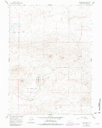
1960 Map of Larsen Knoll
USGS Topo · Published 1981About this map
Larsen Ranch sits at the base of the high country in this high-desert region of Sweetwater County, where the landscape is defined by its seasonal hydrology and distinctive topographic rises. The map traces the Riner Cutoff Road as it winds through the southern portion of the quadrangle, passing through the Mud Springs Flats and near the reliable water source of Mud Springs. This area was mapped as part of the Missouri River Basin development program, documenting a period when ranching outposts and remote wells were the primary human markers on the land.
Find a feature on this map
12 named features on this map. Tap any name to fly to it.
Don’t see what you’re looking for? This feature index may not catch every label — zoom into the map to look around manually.
Map Details
Editions of this 1960 Larsen Knoll Map
2 editions found
Other maps of this area

1954 · Rawlins
USGS Topo · 1:250,000

1955 · Casper
USGS Topo · 1:250,000

1958 · Rawlins
USGS Topo · 1:250,000

1958 · Casper
USGS Topo · 1:250,000

1960 · Hansen Lake NE
USGS Topo · 1:24,000

1960 · Sooner Reservoir
USGS Topo · 1:24,000

1960 · Larsen Knoll
USGS Topo · 1:24,000

1960 · Bull Springs
USGS Topo · 1:24,000

1960 · Buck Draw
USGS Topo · 1:24,000

1960 · Chicken Spring
USGS Topo · 1:24,000