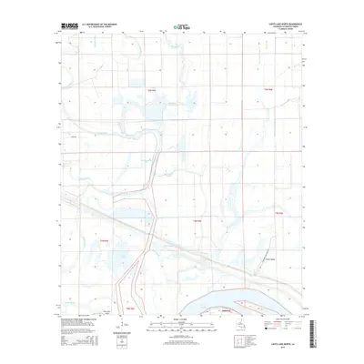
2015 Map of Larto Lake North
USGS Topo · Published 2015About this map
Big Bayou and its winding tributaries dominate this landscape within Catahoula Parish, where a complex network of wetlands and waterways defines the local geography. The map reveals the intricate drainage patterns of the area, including Big Slough, Honey Brake Bayou, and the Big Bayou Cutoff. These water features surround several distinct lakes and glades, most notably Maknockanut Lake, Shad Lake, and the northern edge of Larto Lake.
Find a feature on this map
26 named features on this map. Tap any name to fly to it.
Don’t see what you’re looking for? This feature index may not catch every label — zoom into the map to look around manually.
Map Details
Editions of this 2015 Larto Lake North Map
This is the sole edition of this map. No revisions or reprints were ever made.
Other maps of this area

1935 · Tooleys
USGS Topo · 1:62,500

1941 · Manifest
USGS Topo · 1:62,500

1941 · Jena
USGS Topo · 1:62,500

1941 · Buckeye
USGS Topo · 1:62,500

1941 · Tooleys
USGS Topo · 1:62,500

1953 · Alexandria
USGS Topo · 1:250,000

1953 · Natchez
USGS Topo · 1:250,000

1955 · Alexandria
USGS Topo · 1:250,000

1956 · Natchez
USGS Topo · 1:250,000

1958 · Jena
USGS Topo · 1:62,500