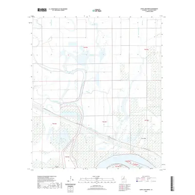
2020 Map of Larto Lake North
USGS Topo · Published 2020About this map
Big Bayou and a complex network of wetlands dominate this portion of Catahoula Parish, where the modern landscape is defined by the massive Larto Lake at its southern edge. The small settlement of Larto serves as the primary hub for this aquatic environment, which is characterized by numerous swampy basins known locally as brakes. Features like Gillespie Brake, Hudson Brake, and Honey Brake Bayou illustrate the intricate hydrology of the area. Engineering efforts to manage the water are visible through the Diversion Canal Levee Rd, which cuts across the marshy terrain near the Big Bayou Cutoff. Landforms like Foster Ridge and Dry Larto Island provide elevated relief amidst the surrounding wetlands, which also include Shad Lake and the winding reaches of Saline Bayou.
Find a feature on this map
26 named features on this map. Tap any name to fly to it.
Don’t see what you’re looking for? This feature index may not catch every label — zoom into the map to look around manually.
Map Details
Editions of this 2020 Larto Lake North Map
This is the sole edition of this map. No revisions or reprints were ever made.
Other maps of this area

1935 · Tooleys
USGS Topo · 1:62,500

1941 · Manifest
USGS Topo · 1:62,500

1941 · Jena
USGS Topo · 1:62,500

1941 · Buckeye
USGS Topo · 1:62,500

1941 · Tooleys
USGS Topo · 1:62,500

1953 · Alexandria
USGS Topo · 1:250,000

1953 · Natchez
USGS Topo · 1:250,000

1955 · Alexandria
USGS Topo · 1:250,000

1956 · Natchez
USGS Topo · 1:250,000

1958 · Jena
USGS Topo · 1:62,500