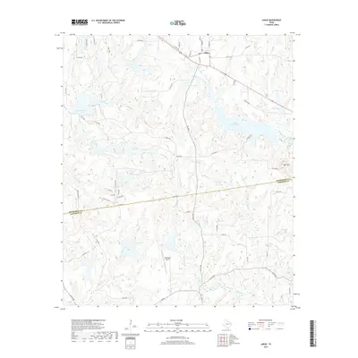
2019 Map of LaRue
USGS Topo · Published 2019About this map
The settlement of LaRue sits at the northern edge of this East Texas survey, where the rolling landscape is defined by an intricate network of creeks and small private reservoirs. The transition across the Henderson Co and Anderson Co line reveals a terrain heavily shaped by water, with Catfish Creek, Alder Creek, and Wolf Creek carving paths through the wooded hills. Distinctive water bodies like Hallmark Lake and the larger Caddo Creek Lake are central landmarks, alongside family-named features such as Leo A Smith Lake and Johns Lake. Away from the water, Rock Hill rises above the surrounding valleys, while the Glad Oaks Airport serves the area's aviation needs. The map illustrates a contemporary pattern of rural development, where a dense grid of county roads, including Co Rd 4516 and An Co 485, connects scattered homesteads and ranches across the two counties.
Find a feature on this map
63 named features on this map. Tap any name to fly to it.
Don’t see what you’re looking for? This feature index may not catch every label — zoom into the map to look around manually.
Map Details
Editions of this 2019 LaRue Map
This is the sole edition of this map. No revisions or reprints were ever made.
Other maps of this area

1949 · Palestine
USGS Topo · 1:62,500

1949 · Frankston
USGS Topo · 1:62,500

1949 · Athens
USGS Topo · 1:62,500

1949 · Tennessee Colony
USGS Topo · 1:62,500

1950 · Athens
USGS Topo · 1:62,500

1950 · Palestine
USGS Topo · 1:62,500

1950 · Frankston
USGS Topo · 1:62,500

1950 · Tennessee Colony
USGS Topo · 1:62,500

1953 · Palestine
USGS Topo · 1:250,000

1956 · Tyler
USGS Topo · 1:250,000