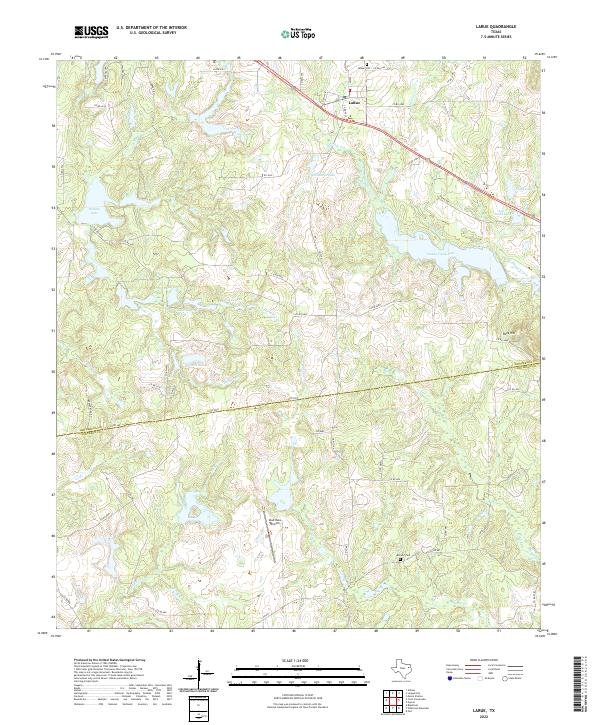
2022 Map of LaRue
USGS Topo · Published 2022About this map
LaRue sits at the junction of FM 607 and Co RD 4719, serving as a focal point in a landscape defined by an intricate network of managed water bodies and seasonal creeks. The terrain transitions across the Henderson Co Anderson Co line, where the topography shifts from the elevated Rock Hill toward the low-lying basins of Caddo Creek Lake and Leo A Smith Lake. This area reflects a complex history of private and community land use, evidenced by named features like Rainbo Lake, Hallmark Lake, and Pharris Lakes. Genealogists can locate established burial grounds such as LaRue Cem in the north and Midway Cem to the south. The presence of Glad Oaks Airport along Wolf Cr highlights the modern utility of these rural stretches, while numerous county roads like HCR 4528 and Co RD 4530 trace the ridges between drainages like Catfish Cr and Brushy Cr.
Find a feature on this map
64 named features on this map. Tap any name to fly to it.
Don’t see what you’re looking for? This feature index may not catch every label — zoom into the map to look around manually.
Map Details
Editions of this 2022 LaRue Map
This is the sole edition of this map. No revisions or reprints were ever made.
Other maps of this area

1949 · Palestine
USGS Topo · 1:62,500

1949 · Frankston
USGS Topo · 1:62,500

1949 · Athens
USGS Topo · 1:62,500

1949 · Tennessee Colony
USGS Topo · 1:62,500

1950 · Athens
USGS Topo · 1:62,500

1950 · Palestine
USGS Topo · 1:62,500

1950 · Frankston
USGS Topo · 1:62,500

1950 · Tennessee Colony
USGS Topo · 1:62,500

1953 · Palestine
USGS Topo · 1:250,000

1956 · Tyler
USGS Topo · 1:250,000