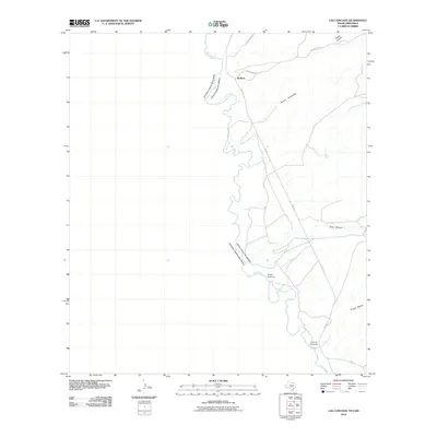
2010 Map of Las Conchas
USGS Topo · Published 2010About this map
The Rio Grande serves as the international boundary between the United States of America and Mexico in this borderlands region. The small settlement of Ruidosa sits along FM 170, marking a central point for local navigation and history. The landscape is defined by the winding river and the dry washes that drain into it, such as Arroyo Escondido and Tijeras Arroyo.
Find a feature on this map
12 named features on this map. Tap any name to fly to it.
Don’t see what you’re looking for? This feature index may not catch every label — zoom into the map to look around manually.
Map Details
Editions of this 2010 Las Conchas Map
This is the sole edition of this map. No revisions or reprints were ever made.
Other maps of this area

1896 · Ruidosa
USGS Topo · 1:125,000

1896 · San Carlos
USGS Topo · 1:125,000

1959 · Presidio
USGS Topo · 1:250,000

1959 · Marfa
USGS Topo · 1:250,000

1965 · Presidio
USGS Topo · 1:250,000

1965 · Marfa
USGS Topo · 1:250,000

1966 · Adobes
USGS Topo · 1:24,000

1978 · Sierra Parda
USGS Topo · 1:24,000

1979 · Ruidosa Hot Springs
USGS Topo · 1:24,000
1979 · Pueblo Nuevo
USGS Topo · 1:24,000