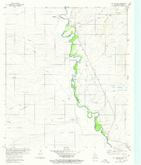
1980 Map of Las Conchas
USGS Topo · Published 1980About this map
The Rio Grande serves as the focal point of this borderlands study, marking the international boundary between Presidio Co in Texas and the state of Chihuahua. This arid landscape is defined by its drainage systems, including the prominent Arroyo Seco and Tijeras Arroyo, which cut through the terrain toward the river valley. Small clusters of habitation and named sites like Ruidosa and Pueblo Nuevo appear along the river corridor, while more isolated settlements like Las Conchas and Chivarrias Blancas are situated further into the interior.
Find a feature on this map
39 named features on this map. Tap any name to fly to it.
Don’t see what you’re looking for? This feature index may not catch every label — zoom into the map to look around manually.
Map Details
Editions of this 1980 Las Conchas Map
This is the sole edition of this map. No revisions or reprints were ever made.
Other maps of this area

1896 · Ruidosa
USGS Topo · 1:125,000

1896 · San Carlos
USGS Topo · 1:125,000

1959 · Presidio
USGS Topo · 1:250,000

1959 · Marfa
USGS Topo · 1:250,000

1965 · Presidio
USGS Topo · 1:250,000

1965 · Marfa
USGS Topo · 1:250,000

1966 · Adobes
USGS Topo · 1:24,000

1978 · Sierra Parda
USGS Topo · 1:24,000

1979 · Ruidosa Hot Springs
USGS Topo · 1:24,000
1979 · Pueblo Nuevo
USGS Topo · 1:24,000