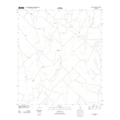
2013 Map of Las Flores
USGS Topo · Published 2013About this map
Las Flores and the San Jose Ranch anchor this Frio County landscape, illustrating a region defined by cattle ranching and water management. The terrain is marked by an extensive network of windmills, including the Caballo Blanco Windmill, Ruiz Windmill, and Thompson Windmill, which speak to the essential infrastructure required for survival in this part of South Texas. These water-lifting sites are scattered across a watershed carved by seasonal drainages such as Ruiz Cr, Rock Cr, and Esperanza Cr. Managed water storage is further evidenced by named reservoirs like Caldwell Tank and Harry Tank. Transportation is limited to a sparse grid of rural routes like FM 1582 and Kothman Rd, connecting these isolated ranching operations across the brush country.
Find a feature on this map
29 named features on this map. Tap any name to fly to it.
Don’t see what you’re looking for? This feature index may not catch every label — zoom into the map to look around manually.
Map Details
Editions of this 2013 Las Flores Map
This is the sole edition of this map. No revisions or reprints were ever made.
Other maps of this area

1927 · Pearsall
USGS Topo · 1:62,500

1934 · Schattel
USGS Topo · 1:62,500

1942 · Dilley
USGS Topo · 1:62,500

1953 · Crystal City
USGS Topo · 1:250,000

1955 · Crystal City
USGS Topo · 1:250,000

1956 · Hindes
USGS Topo · 1:62,500

1961 · Crystal City
USGS Topo · 1:250,000

1964 · Pearsall South
USGS Topo · 1:24,000

1968 · Crystal City
USGS Topo · 1:250,000
1968 · Keystone Ranch
USGS Topo · 1:24,000