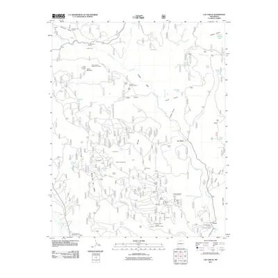
2011 Map of Las Tablas
USGS Topo · Published 2011About this map
Rio Tusas carves a path through this high-altitude landscape of northern New Mexico, framing a region defined by its intense mineral exploration and small mountain settlements. The map centers on the Mesa De La Jarita, a plateau marked by an incredible density of mining activity. Rare earth and industrial mineral sites are scattered throughout, including the Saint Christopher Columbite Plate, Vestegard Mine, and the Lonesome Mine. Small community hubs like Las Tablas and Petaca anchor the eastern side of the quadrangle, while smaller locations such as Maulsby, Wyoming, and Veseley appear as distinct points of interest for local history. The land's verticality is evidenced by the deep incision of the Tusas Box and the heights of Kiowa Mountain, where the Kiowa Mountain Molybdenite Prospect indicates the geological diversity of the Sangre de Cristo foothills.
Find a feature on this map
80 named features on this map. Tap any name to fly to it.
Don’t see what you’re looking for? This feature index may not catch every label — zoom into the map to look around manually.
Map Details
Editions of this 2011 Las Tablas Map
This is the sole edition of this map. No revisions or reprints were ever made.
Other maps of this area

1918 · Abiquiu
USGS Topo · 1:125,000

1918 · Tusas
USGS Topo · 1:125,000

1953 · Valle Grande Peak
USGS Topo · 1:24,000

1953 · La Madera
USGS Topo · 1:24,000

1954 · Raton
USGS Topo · 1:250,000

1954 · Aztec
USGS Topo · 1:250,000

1958 · Raton
USGS Topo · 1:250,000

1958 · Aztec
USGS Topo · 1:250,000

1961 · Servilleta Plaza
USGS Topo · 1:24,000

1962 · Aztec
USGS Topo · 1:250,000