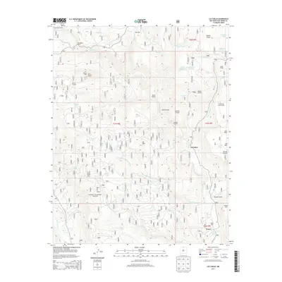
2013 Map of Las Tablas
USGS Topo · Published 2013About this map
Las Tablas and Petaca serve as the primary human settlements in this high-elevation landscape within the Carson National Forest. The geography is defined by a series of rugged mesas and canyons, most notably Mesa de la Jarita and Petaca Mesa, which rise above the drainages of the Rio Tusas and Rio Vallecitos. A prominent landmark for the region is the Kiowa Mountain Lookout atop Kiowa Mtn, providing a strategic vantage point over the complex terrain of Kiowa Canyon and Hondo Canyon. This area's water management is visible through numerous named tanks and springs, such as McIntyre Spring and Hondito Tank, which were essential for ranching and forest operations. The map also captures the distinct geological features like Big Rock and the narrow passage of Tusas Box, illustrating the natural constraints on movement and settlement in Rio Arriba County.
Find a feature on this map
52 named features on this map. Tap any name to fly to it.
Don’t see what you’re looking for? This feature index may not catch every label — zoom into the map to look around manually.
Map Details
Editions of this 2013 Las Tablas Map
This is the sole edition of this map. No revisions or reprints were ever made.
Other maps of this area

1918 · Abiquiu
USGS Topo · 1:125,000

1918 · Tusas
USGS Topo · 1:125,000

1953 · Valle Grande Peak
USGS Topo · 1:24,000

1953 · La Madera
USGS Topo · 1:24,000

1954 · Raton
USGS Topo · 1:250,000

1954 · Aztec
USGS Topo · 1:250,000

1958 · Raton
USGS Topo · 1:250,000

1958 · Aztec
USGS Topo · 1:250,000

1961 · Servilleta Plaza
USGS Topo · 1:24,000

1962 · Aztec
USGS Topo · 1:250,000