1893 Map of Las Vegas
USGS Topo · Published 1900About this map
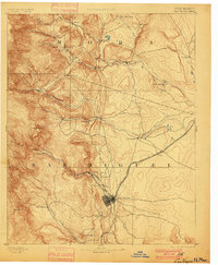
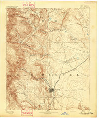
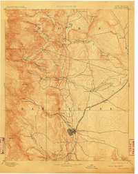
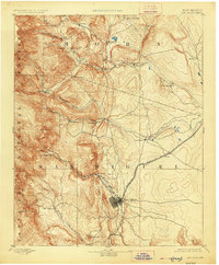
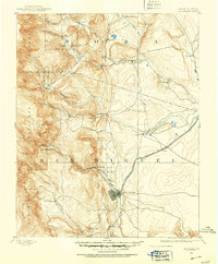
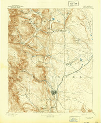
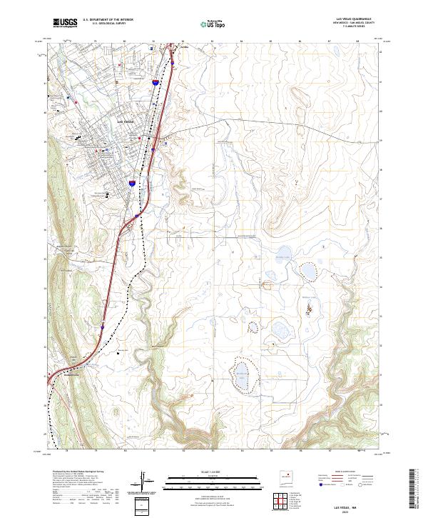
Las Vegas serves as the primary hub of this 1889 survey, appearing as a dense grid at the intersection of mountain and prairie. The Atchison Topeka and Santa Fe Railroad cuts through the territory, linking the city to smaller settlements like Onava and Romero. This late nineteenth-century view captures a complex network of Spanish-named plazas and agricultural outposts along the Mora River and its tributaries, including La Cueva and Golondrinos. To the northeast, the presence of Fort Union indicates the area's strategic military importance during the frontier era. The terrain transitions from the high peaks of Solitario Pk and Barillas Pk in the west down toward the Sapello Creek drainage. Notable local landmarks like the Hot Springs near the Gallinas Creek suggest the early development of the region's medicinal and recreational sites before the turn of the century.
Find a feature on this map
38 named features on this map. Tap any name to fly to it.
Don’t see what you’re looking for? This feature index may not catch every label — zoom into the map to look around manually.
Map Details
Editions of this 1893 Las Vegas Map
5 editions found
Historical Maps of Las Vegas Through Time
9 maps found
1889 Las Vegas
San Miguel County, NM

1891 Las Vegas
San Miguel County, NM
1893 Las Vegas
San Miguel County, NM
1963 Las Vegas
San Miguel County, NM
2010 Las Vegas
San Miguel County, NM
2013 Las Vegas
San Miguel County, NM
2017 Las Vegas
San Miguel County, NM
2020 Las Vegas
San Miguel County, NM
2023 Las Vegas
San Miguel County, NM