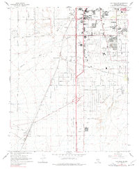
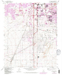
1967 Map of Las Vegas SW
USGS Topo · Published 1977About this map
M C Carran Field dominates the central landscape of this 1967 survey, providing a snapshot of the region's rapid development during the late 1960s. The northern portion of the map shows a transition from structured urban blocks to more open land, with prominent institutions like Nevada Southern University and Paradise Sch established in the Paradise Valley area. Significant recreation and entertainment sites are already in place, including the Stardust International Raceway, Las Vegas Downs Racetrack, and the Tropicana Country Club.
Find a feature on this map
51 named features on this map. Tap any name to fly to it.
Don’t see what you’re looking for? This feature index may not catch every label — zoom into the map to look around manually.
Map Details
Editions of this 1967 Las Vegas SW Map
5 editions found
Other maps of this area

1907 · Las Vegas
USGS Topo · 1:250,000

1908 · Las Vegas
USGS Topo · 1:250,000

1910 · Ivanpah
USGS Topo · 1:250,000

1912 · Ivanpah
USGS Topo · 1:250,000

1942 · Ivanpah
USGS Topo · 1:250,000

1947 · Kingman
USGS Topo · 1:250,000

1948 · Kingman
USGS Topo · 1:250,000

1952 · Blue Diamond
USGS Topo · 1:62,500

1952 · Las Vegas
USGS Topo · 1:62,500

1954 · Las Vegas
USGS Topo · 1:250,000