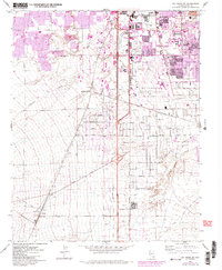
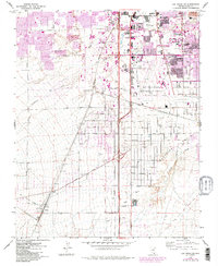
1967 Map of Las Vegas SW
USGS Topo · Published 1984About this map
Mc Carran International Airport and the surrounding desert landscape dominate this 1967 survey, capturing a pivotal moment before the massive urban expansion of later decades. The University of Nevada-Las Vegas is visible on the northeastern edge, flanked by early suburban developments along Twain Ave and Flamingo Road. Purple revision tinting from the mid-1980s reveals the rapid spread of housing into the open land between the airport and the Union Pacific rail line.
Find a feature on this map
43 named features on this map. Tap any name to fly to it.
Don’t see what you’re looking for? This feature index may not catch every label — zoom into the map to look around manually.
Map Details
Editions of this 1967 Las Vegas SW Map
5 editions found
Other maps of this area

1907 · Las Vegas
USGS Topo · 1:250,000

1908 · Las Vegas
USGS Topo · 1:250,000

1910 · Ivanpah
USGS Topo · 1:250,000

1912 · Ivanpah
USGS Topo · 1:250,000

1942 · Ivanpah
USGS Topo · 1:250,000

1947 · Kingman
USGS Topo · 1:250,000

1948 · Kingman
USGS Topo · 1:250,000

1952 · Blue Diamond
USGS Topo · 1:62,500

1952 · Las Vegas
USGS Topo · 1:62,500

1954 · Las Vegas
USGS Topo · 1:250,000