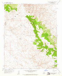
1959 Map of Las Yeguas Ranch
USGS Topo · Published 1961About this map
Temblor Range peaks dominate this mid-century survey along the high-desert border of San Luis Obispo and Kern counties. This is a landscape of isolated livestock operations and scattered water sources, where remote outposts like Las Yeguas Ranch and Ross Ranch anchor a network of ephemeral streams and canyons. The presence of a dedicated Landing Strip near the ranch indicates the necessity of aerial access in this sparsely populated region during the late 1950s.
Find a feature on this map
25 named features on this map. Tap any name to fly to it.
Don’t see what you’re looking for? This feature index may not catch every label — zoom into the map to look around manually.
Map Details
Editions of this 1959 Las Yeguas Ranch Map
2 editions found
Other maps of this area

1912 · McKittrick
USGS Topo · 1:125,000

1914 · Lost Hills
USGS Topo · 1:125,000

1914 · Cholame
USGS Topo · 1:125,000

1915 · Cholame
USGS Topo · 1:125,000

1917 · Cholame
USGS Topo · 1:125,000

1932 · La Panza
USGS Topo · 1:48,000

1935 · La Panza
USGS Topo · 1:62,500

1936 · La Panza
USGS Topo · 1:62,500

1943 · Packwood
USGS Topo · 1:31,680

1943 · Simmler
USGS Topo · 1:62,500