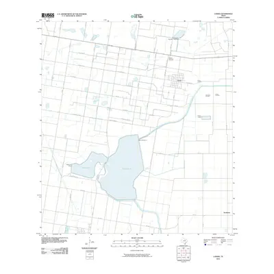
2010 Map of Lasara
USGS Topo · Published 2010About this map
Lasara serves as the primary hub of this South Texas landscape, where the rectilinear grid of agricultural roads meets an intricate system of water management. The community is surrounded by several significant burial sites, including the Lasara Memorial Cemetery and Garcia Cemetery, which provide vital touchstones for family historians. To the southeast, the small settlement of Stockholm sits near the intersection of FM 1422 and FM 491.
Find a feature on this map
45 named features on this map. Tap any name to fly to it.
Don’t see what you’re looking for? This feature index may not catch every label — zoom into the map to look around manually.
Map Details
Editions of this 2010 Lasara Map
This is the sole edition of this map. No revisions or reprints were ever made.
Other maps of this area

1922 · La Sal Vieja
USGS Topo · 1:62,500

1929 · Santa Rosa
USGS Topo · 1:24,000

1933 · Santa Rosa
USGS Topo · 1:31,680

1939 · Linn
USGS Topo · 1:62,500

1949 · Mc Allen
USGS Topo · 1:250,000

1953 · Brownsville
USGS Topo · 1:250,000

1954 · McAllen
USGS Topo · 1:250,000

1956 · La Sal Vieja
USGS Topo · 1:24,000

1956 · Santa Rosa
USGS Topo · 1:24,000

1956 · Yturria
USGS Topo · 1:24,000