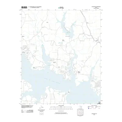
2010 Map of Lassater
USGS Topo · Published 2010About this map
Lake O' the Pines dominates this Marion County landscape, its expansive waters and intricate shoreline reaching into every corner of the terrain. The map captures the complex interaction between the reservoir's fingers and the local infrastructure, particularly around Rock Springs and the settlement of Victory. Resource extraction is a primary feature of the uplands, where the Lassater Gas Field and Lake Ferrell Oil Field reveal the industrial footprint of the early 21st century. Along the northern reaches, Johnson Creek Reservoir and its associated dam contribute to the managed water system of the Big Cypress Creek basin.
Find a feature on this map
48 named features on this map. Tap any name to fly to it.
Don’t see what you’re looking for? This feature index may not catch every label — zoom into the map to look around manually.
Map Details
Editions of this 2010 Lassater Map
This is the sole edition of this map. No revisions or reprints were ever made.
Other maps of this area

1956 · Tyler
USGS Topo · 1:250,000

1961 · Cunningham Creek
USGS Topo · 1:24,000

1961 · Lassater
USGS Topo · 1:24,000

1961 · Harleton
USGS Topo · 1:24,000

1962 · Kellyville
USGS Topo · 1:24,000

1962 · Marshall NW
USGS Topo · 1:24,000

1962 · Ashland
USGS Topo · 1:24,000

1962 · Avinger
USGS Topo · 1:24,000

1962 · Ore City
USGS Topo · 1:24,000

1962 · Lone Star
USGS Topo · 1:24,000