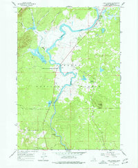
1964 Map of Last Chance
USGS Topo · Published 1977About this map
Henrys Fork dominates this portion of the Targhee National Forest as it meanders through eastern Idaho in the mid-1960s. The settlement of Last Chance stands at the northern edge of this survey, serving as a gateway for travelers and sportsmen near the Landing Strip. The map reveals a landscape defined by its hydrology, where Silver Lake and Golden Lake are fed by the intricate branches of Thurmon Creek.
Find a feature on this map
36 named features on this map. Tap any name to fly to it.
Don’t see what you’re looking for? This feature index may not catch every label — zoom into the map to look around manually.
Map Details
Editions of this 1964 Last Chance Map
3 editions found
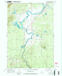
Other maps of this area

1955 · Ashton
USGS Topo · 1:250,000

1958 · Ashton
USGS Topo · 1:250,000

1960 · Ashton
USGS Topo · 1:250,000

1964 · Hatchery Butte
USGS Topo · 1:24,000

1964 · Island Park
USGS Topo · 1:24,000

1964 · Island Park Dam
USGS Topo · 1:24,000

1964 · Last Chance
USGS Topo · 1:24,000

1965 · Lookout Butte
USGS Topo · 1:24,000

1965 · Snake River Butte
USGS Topo · 1:24,000

1965 · Blue Creek Reservoir
USGS Topo · 1:24,000