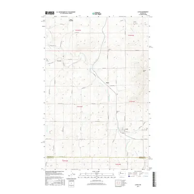
2017 Map of Latah
USGS Topo · Published 2017About this map
Hangman Creek winds through this agricultural landscape of southern Spokane County, serving as the primary drainage for a region defined by its small farming communities and elevated terrain. The settlement of Waverly occupies a central position along the Palouse Hwy, while the town of Latah is situated further south where Cove Cr meets the main creek. These communities, alongside smaller points like Rahm and West Fairfield, reflect the persistent rural character of the Inland Northwest in the early twenty-first century.
Find a feature on this map
58 named features on this map. Tap any name to fly to it.
Don’t see what you’re looking for? This feature index may not catch every label — zoom into the map to look around manually.
Map Details
Editions of this 2017 Latah Map
This is the sole edition of this map. No revisions or reprints were ever made.
Other maps of this area

1903 · Oakesdale
USGS Topo · 1:125,000

1905 · Oakesdale
USGS Topo · 1:125,000

1954 · Spangle
USGS Topo · 1:62,500

1954 · Fairfield
USGS Topo · 1:62,500

1955 · Spokane
USGS Topo · 1:250,000

1958 · Spokane
USGS Topo · 1:250,000

1964 · Oakesdale
USGS Topo · 1:24,000

1964 · Tekoa
USGS Topo · 1:24,000
1964 · Rosalia
USGS Topo · 1:24,000
1980 · Fairfield
USGS Topo · 1:24,000