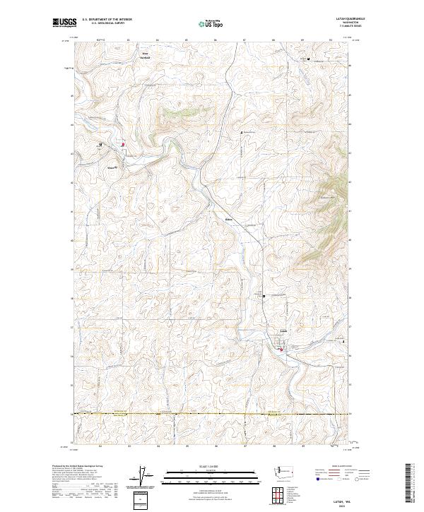
2023 Map of Latah
USGS Topo · Published 2023About this map
Hangman Creek and its tributaries, including Rattler Run Creek and Spring Valley Creek, carve a distinct drainage system across this part of the Palouse. The settlement of Latah serves as a primary focal point in the southeast, situated near the junction of Gove Creek and the main waterway. This agricultural landscape is punctuated by several small communities such as Waverly, West Fairfield, and the siding at Rahm. For those tracing local heritage, the map identifies numerous burial sites, including the Latah Evergreen Cem, Waverly Cem, and Rosewood Cem. The terrain transitions from the alluvial flats of the creek bottoms to the heights of Gelbert Mtn, while the boundary between Spokane Co and Whitman Co runs along the southern edge of the quadrangle.
Find a feature on this map
60 named features on this map. Tap any name to fly to it.
Don’t see what you’re looking for? This feature index may not catch every label — zoom into the map to look around manually.
Map Details
Editions of this 2023 Latah Map
This is the sole edition of this map. No revisions or reprints were ever made.
Other maps of this area

1903 · Oakesdale
USGS Topo · 1:125,000

1905 · Oakesdale
USGS Topo · 1:125,000

1954 · Spangle
USGS Topo · 1:62,500

1954 · Fairfield
USGS Topo · 1:62,500

1955 · Spokane
USGS Topo · 1:250,000

1958 · Spokane
USGS Topo · 1:250,000

1964 · Oakesdale
USGS Topo · 1:24,000

1964 · Tekoa
USGS Topo · 1:24,000
1964 · Rosalia
USGS Topo · 1:24,000
1980 · Fairfield
USGS Topo · 1:24,000